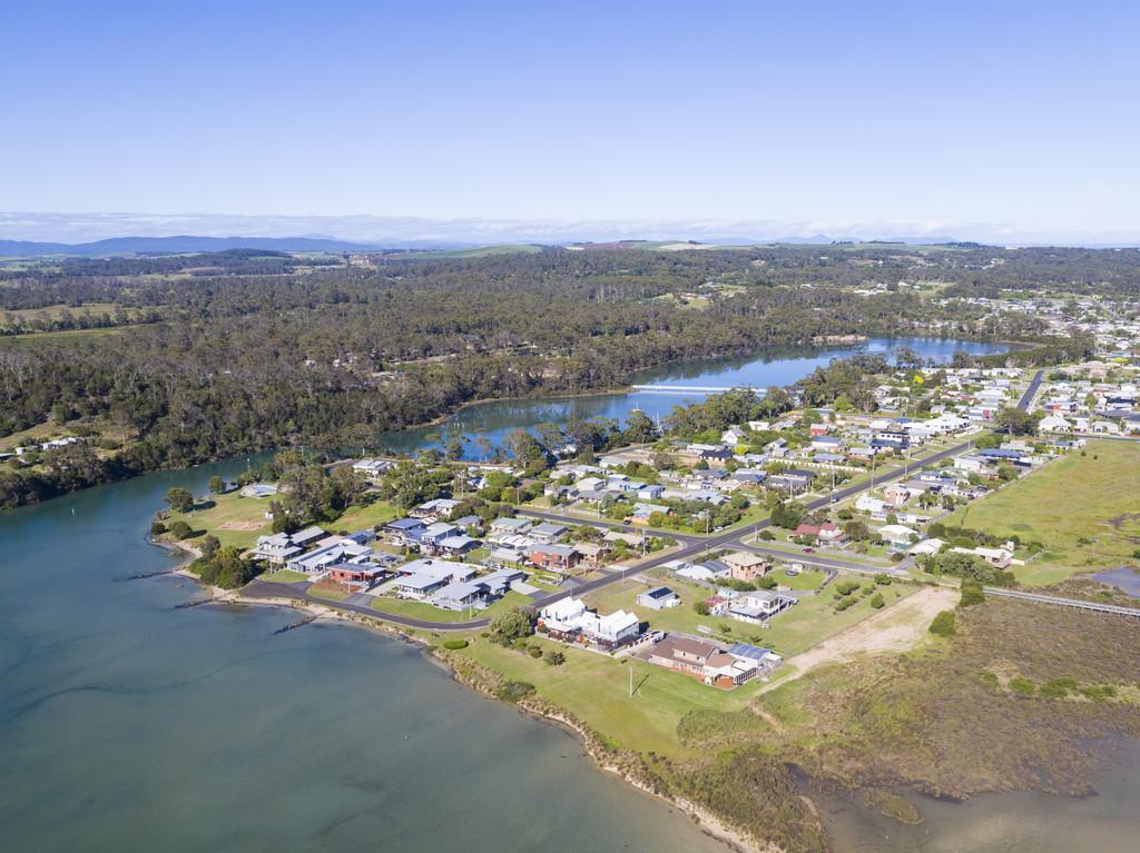
Project: Port Sorell Area Drainage
Update April 2024: Council commissioned the recently finalised report from GHD titled Sankey Street, Hawley Stormwater Improvements.
Sankey Street, Hawley Stormwater Improvements Report
Since June 2020, several properties in Sankey Street and Hawley Esplanade have experienced stormwater inundation. The most recent significant event occurred on the night of 28 February 2023 and 1 March 2023 which was likely to have been between a 1%AEP and a 0.2% AEP rainfall event which is an infrequent/rare event.
Council has a capital budget allocation to address this issue.
GHD has assessed the hydraulic performance of the Sankey Street Stormwater Catchment using the ARR (Australian Rainfall and Runoff) 2019 guidelines and the computer program InfoWorks ICM for the minor (10% AEP) and major (1% AEP) design storm events. The analysis indicated widespread flooding/inundation to properties in Sankey Street with the existing detention basin spilling for both design events.
At the March 2024 Council endorse the following recommendations:
1. Note that an application for Disaster Resilience Funding to assist with the project is being prepared; and
2. Receive the report prepared by GHD titled Sankey Street, Hawley Stormwater Improvements dated 02 February 2024; and
3. Acknowledge that kerb and channel has been identified as the preferred means to better contain overland flow within the road reservation;
4. An update and copy of the report be placed on Councils website and this be communicated with residents in both Sankey Street and Arthur Place; and
5. Council officers have the work undertaken by GHD furthered on the following basis:
a. That kerb and channel be installed in Sankey Street to form an overland flow path from the western end towards the foreshore and will have fall across Hawley Esplanade (either raised sag in Sankey Street or localised lowering of Hawley Esplanade;
b. That the existing detention basin be retained and potentially receive minor modifications as determined necessary; and
c. That 1% AEP (Annual Exceedance Probability) climate change runoff that cannot be managed within the existing detention basin, the existing pipework in Sankey Street or the proposed overland flow path between kerbs in Sankey Street be catered for within an upgraded (either duplicate or upsized) pipework within Sankey Street to the foreshore.
Update August 2023: STAGE 1 REPORT RECEIVED AND STAGE 2 COMMENCED
The Stage 1 report for the detailed stormwater catchment assessment of Poyston Creek at Port Sorell has been received from Hydrodynamica. Stage 2 has commenced.
This assessment results primarily from the need to better understand the current and future performance of the Poyston Creek Catchment which forms part of Councils stormwater system in the urban area. Changing rainfall patterns and ongoing development has driven this review.
This catchment is a priority for three main reasons:
- OneCare is looking to further expand its facilities relatively closely to the overland flow path near the south-western corner of their property fronting Burgess Drive. Certainty on the flood potential both pre and post upstream development is required. The nearby Council land may hold some greater purpose to assist in managing stormwater directly or indirectly;
- The proposed subdivision west of OneCare and Burgess Drive is part of this catchment and a validation of the likely impacts of the development and conceptual stormwater detention system is required; and
- The loss of play time on the golf course after heavy rain in relation to the drain through the site and outfall, noting that sand and high tides reduce the capacity of the outfall considerably. Note that climate change predictions are that this area will subject to rising sea levels in the future and has potential to become less and less playable irrespective of stormwater flows.
Catchment Assessment Stage 1 Report
The scope of stage 2 follows:
- The potential sites for, and provision of, detention basins above Alexander Street and the effect on lower catchment flooding;
- Overland flow path linkages from the upper catchment to the lower catchment;
- Lower catchment (below Alexander Street) volumes and the effect of an eastern diversion to additional detention facility on Camp Banksia land including a new outfall to Freers Beach;
- Reprofiling of the drainage line through the golf course to provide additional storage, when the outfall is restricted by a high tide (assumes Tideflex or similar check valve installed); and
- A combination of upper and lower catchment interventions described above.
Subject to community interest there is potential to hold a drop in session(s) for more detailed discussions after stage 2 is complete.
Update October 2022:
Sankey Street
The overland flow path can be practically created along Sankey Street by the installation of kerbs will not have the desired capacity for extreme events. Further stormwater modelling has been undertaken and a concept developed to create additional capacity in the piped network to carry runoff that would normally be conveyed in an overland flow path. The concepts are being further developed for sharing with the residents of the street.
Taroona Street
Capital works in future years are likely to be informed by the Sankey Street project outcomes.
Golf Course
Surveying of the existing stormwater network in the catchment has been commissioned and once complete our consultant, Hydrodynamica will be preparing a stormwater model to assess the current network performance, the impact of further development in the catchment and help inform future drainage priorities and works. This investigation is due late in 2022.
Scope: Initial Phase
Inundation of properties due to flooding on 28th February / 1st March 2022
As many residents know, the Hawley Beach/Port Sorell/Shearwater area received significant rainfall overnight on 28 February 2022 and 1 March 2022.
From the information collated from private rain gauges, we understand between 86mm and 100mm of rain fell in the area between midnight and 6:30am.
Council is currently sourcing and reviewing information available from the Bureau of Meteorology to further understand the event and to see how it compares to the information we have collated.
The Bureau does not have a rain gauge in the Hawley Beach / Shearwater area. Also, it is known the rainfall recorded at the Devonport Airport differs from the rainfall received in the Hawley Beach / Port Sorell / Shearwater area. However, the Bureau can generate rainfall data for the area using the rain radar and rain gauge observations.
Based on the information we have, the rainfall (based on 6.5 hours duration) is likely to have exceeded the 100-year ARI, or the 1% Annual Exceedance Probability (AEP). This basically means the likelihood of this event, or a larger event occurring in any one year is 1% (or less) based on published statistical rainfall design information.
Putting it simply, the rainfall event exceeded the design capacity of the Council Stormwater System. The underground piped system is simply not sized for the run-off generated by this type of event. In many instances the rainfall overloaded the stormwater systems which resulted in inundation of properties as water flowed with the natural fall of the land, known as ‘overland flow’.
It is important to note that natural or man-made overland flow paths are not necessarily on council land and may not always be kept “clear of obstructions or diversions.”
Proposed Action
Of the reports received, Sankey Street was most greatly impacted, with water entering several properties and habitable rooms. Other affected areas included Taroona Street, Dumbleton Street and the Port Sorell Golf Course.
Council is currently looking at these sites as to determine what action can be undertaken to mitigate against future events.
A summary of the proposed action considerations are outlined below, which are still subject to further investigation:
Sankey Street
- Main items identified:
- Capacity of the Detention Basin exceeded overnight – resulting in the basin spilling into Sankey Street and the property next door and taking an overland flow path across Joyce Street and through properties downstream.
- Manhole immediately downstream of basin – internal water level likely exceeded the surface level of the manhole, resulting in hydraulic forces acting on and lifting/shifting the manhole surround and lid.
- Capacity of the pipe and pit system exceeded – resulting in water spilling into No.32.
- Contributions to the overland flow down Sankey Street from the catchment areas to the north, west and south of the Sankey Street / Joyce Street intersection.
- Potential Improvements:
- Subject to additional information available from the Bureau the potential installation of a rain gauge station in the Hawley/Shearwater/Port Sorell area. This provides the ability to calibrate and validate existing and future hydraulic catchment models based on historical events, which in turn gives a more accurate approximation on results or outcomes when changes or improvements are proposed to the drainage network.
- Review the drainage catchment model and use 2016 design rainfall data, with consideration of incorporating climate effects/projections on the design rainfall data. Incorporate the major and minor design events as per Council’s Stormwater Management Plan.
- Option 1:
- Retain and increase the capacity of the detention basin to accommodate a 1% AEP event (or larger) with consideration of future climate effects/projections as noted above to increase protection to the adjoining units and downstream properties.
- Creation of a formed overland flow path downstream of the detention basin and the Joyce St / Sankey Street intersection to intercept and contain overland flows and spills from the basin and transport them east along Sankey Street to the foreshore area. This will also require locally lowering the Sankey St / Hawley Esplanade intersection.
The proposal is to use Sankey Street as the overland flow path with the provision of kerbs and channel with minor mounding of the verges (other options include open drains or full mounding of the verge without kerb and channel, etc.) to contain the flow to the street and minimise flows entering adjoining properties. This would be extended north along Joyce St from the Sankey St / Joyce St intersection to intercept overland flows crossing Joyce Street.
Kerb and channel may be extended into Arthur Place to provide further protection to downstream properties. This work may also include the provision of a piped overflow system from the basin which would directly discharge to the foreshore area.
- Replace the inlet and outlet grates of the basin with new structures to minimise blockages. The outlet structure is to be designed to include an inclined bar screen so it can be racked/cleared.
- Integrate the manhole downstream of the basin to become one whole unit to resist the hydraulic forces acting on the surround and access cover.
- Disburse discharges and employ energy dissipation measures to minimise erosion to the foreshore/beach area for acceptable design events.
- Option 2:
- Remove the detention basin and upsize/duplicate the downstream pipework to accommodate the increase in downstream flows. This will involve some alteration and extension of the existing pipework upstream of the basin.
- Create the overland flow path down Sankey Street (from option 1). Overland flow to cater for major storm events (1% AEP event).
- Remediate the detention basin site (optional) and sell the land. Use funds from the sale to offset the cost of the capital works.
- Disburse discharges and employ energy dissipation measures to minimise erosion to the foreshore/beach area for acceptable design events.
Dumbleton Street
- Evidence of minor permeability issues with the upper course of the detention basin wall.
- Hydraulic grade line/water line exceeding the surface level of inlet pipework and manholes structures causing water spilling from the basin and potentially into adjoining properties.
- Excess runoff overtopping the kerb and footpath in Garnet place and becoming overland flow.
- Changes to the general topography during and following construction activity resulting in changes in the overland flow paths.
- Potential insufficient capacity of the spillway for a major storm event.
- Development within the overland flow path.
- Potential Improvements:
- Seal up minor gaps in wall.
- Increase capacity of spillway.
- Consider increase to basin volume.
- Manipulate current overland flow path.
Taroona Street
- Main items identified:
- Limited formed stormwater infrastructure (i.e. swale drain or similar on the northern side in places). Results in run-off following the fall of the land into private properties which are lower than the road, which flows into lower lying properties at the eastern end of Taroona Street.
- The swale drain on the southern side of road no longer functions in places, and several driveways obstruct the use of the verge as a natural swale. Also, some pits are higher than the surrounding ground level and as such are ineffective in picking up the overland flow and ground water in the area.
- Potential Improvements:
- Develop and review the existing drainage catchment model for the street and use 2016 design rainfall data, with consideration of incorporating Climate effects/projections on the design rainfall data. Incorporate the major and minor design events as per Council’s Stormwater Management Plan.
- Undertake drainage works to improve the performance of the drainage system, which includes:
- Install swales, mounds or kerb and channel to intercept, contain and transport overland flows collected by the road to the foreshore area. Levels will confirm the extent of work required. Kerb and channel are preferred due to its hard-wearing, long-lasting characteristics, with minor mounding of the verge if required.
This will be supplemented with new road pits and additional pipe works/upgrades as identified from the model.
- Re-construction and re-profiling of driveways to suit the new kerb and channel or swales. Swale drains will require the formation of depressions in the driveway or the installation of culverts and headwalls depending on the topography, driveway profile and flow rates.
Golf Course
- Main items identified:
- Ongoing concern from the Port Sorell Golf Club regarding temporary inundation of the course. It has been suggested that the flooding directly results from development within the catchment but there are many more contributing factors including sand in the outfall, extremely flat gradients and slow flows, shallowness of pipes and drains, the bottom of the drain being well below the high tide mark, climate patterns, location of ‘sensitive’ development, and the outfall and Pitcairn Street culvert capacity.
- Potential Improvements:
- Investigate options to reduce the occurrence of sand build up in the outfall.
- Continue to require development within the catchment to install on-site detention storage.
- Consider what options are available to facilitate or require development in the area to collect and reuse stormwater.
- Model the catchment in greater detail and consider widening channels and building off-line buffer storages.
Conclusion
Council notes that kerb and channel has historically not been widely supported in the Hawley area and consultation with property owner needs to occur if this infrastructure is to be installed. Other practical improvement options are likely to be limited.
The provision of additional protection over and above normal design rainfall events is a balance between the cost of infrastructure, the cost of what is being protected and the risk of the event occurring and the damage that may result. Also, it is important to note that rainfall in Australia has displayed both large natural variability and large trends during the past two decades. Variability is largely due to large-scale atmospheric and oceanic drivers that affect the region.
Any proposed improvement needs to consider the effects of future climate change going forward, especially when the exposure risk to climate change is medium to high.
Council asks residents who have been impacted by the recent rainfall event to get in touch with us (if they haven’t already done so) to help us to further understand how you were impacted, where the limitations of our network are and to consider potential future improvement works.
It is important to note we are living in changing climate along with continued growth which presents challengers now and into the future, especially with expected changes in rainfall which need to be considered in the design and planning of drainage infrastructure